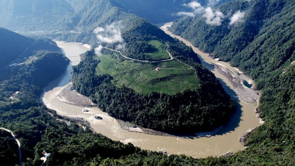
A group of Chinese geologists has raised concerns about the safety of the world’s largest hydropower project, under construction on the Brahmaputra River (the Yarlung Tsangpo) in Tibet. Their research found that an active fault line lies directly beneath the mega-dam, which could pose a major risk to the structure’s stability in the future.
The construction of the huge upstream dam has long been a source of concern in India and Bangladesh. The research was published last month in the Chinese-language journal Sedimentary Geology and Tethyan Geology, under the supervision of the state-run China Geological Survey. It says the Paizen Fault in the eastern Himalayan region has been highly active since the Pleistocene ice age, and that because the fault lies very close to the dam’s reservoir area, it could threaten not only the dam but also nearby roads, bridges, tunnels and other key infrastructure.
The study was carried out by geologists from the Chengdu University of Technology, the China Geological Survey’s Civil-Military Integration Center, and the Middle Yarlung Tsangpo River Natural Resources Observation and Research Station. The researchers said the long-term activity of the Paizen Fault had created numerous cracks in the surrounding rock layers and changed their mechanical properties, leaving the bearing capacity and stability of the soil and rock much weaker than before – which could also affect the foundations of large engineering projects.
The paper said the Paizen area lies within the reservoir zone of the Yarlung Tsangpo hydropower project, where the ground is loose and the soil’s cohesion relatively low. As a result, being submerged for long periods, combined with fault movement or earthquakes, could easily destabilize the hill slopes on either side and trigger landslides. The researchers recommended that engineers strengthen slope stability, build retaining walls and take special landslide-prevention measures, saying such safeguards were essential throughout construction and operation.
China began building the mega-dam on the Tibetan plateau last year, with a target of generating about 300 billion kilowatt-hours of electricity a year – roughly three times the capacity of the Three Gorges Dam, currently the world’s largest hydropower station. After leaving Tibet, the Yarlung Tsangpo becomes known as the Brahmaputra as it enters India’s Arunachal Pradesh and Assam, and later flows into Bangladesh as the Jamuna. For this reason, the upstream dam has long worried India and Bangladesh, raising questions about its possible effects on water flow, the environment, biodiversity and the water security of downstream countries.
The research also said the Paizen area lies in one of the most earthquake-prone zones of the Himalayas, where the collision of the Indian and Eurasian tectonic plates causes frequent strong earthquakes, creating a highly active seismic zone around the Yarlung Tsangpo. According to the geologists, the Paizen Fault has been active since the early Pleistocene and remains active in the present Holocene epoch; analysis of ancient lake sediments shows it was active as recently as about 9,500 years ago. The researchers also cited a magnitude-6.9 earthquake that struck the Milin area of Tibet in 2017, which they said occurred at the northern end of the Paizen Fault and still demonstrates its capacity to produce strong earthquakes.
The paper warned that regional earthquakes could easily cause landslides in the future, seriously threatening the dam, roads, bridges, tunnels and other important infrastructure, as well as the safety of people working there. The researchers therefore placed special emphasis on further strengthening structural safety and taking effective landslide-prevention measures at every stage of construction and operation.
বাংলায় মূল প্রতিবেদন পড়ুন · Read the original Bengali report