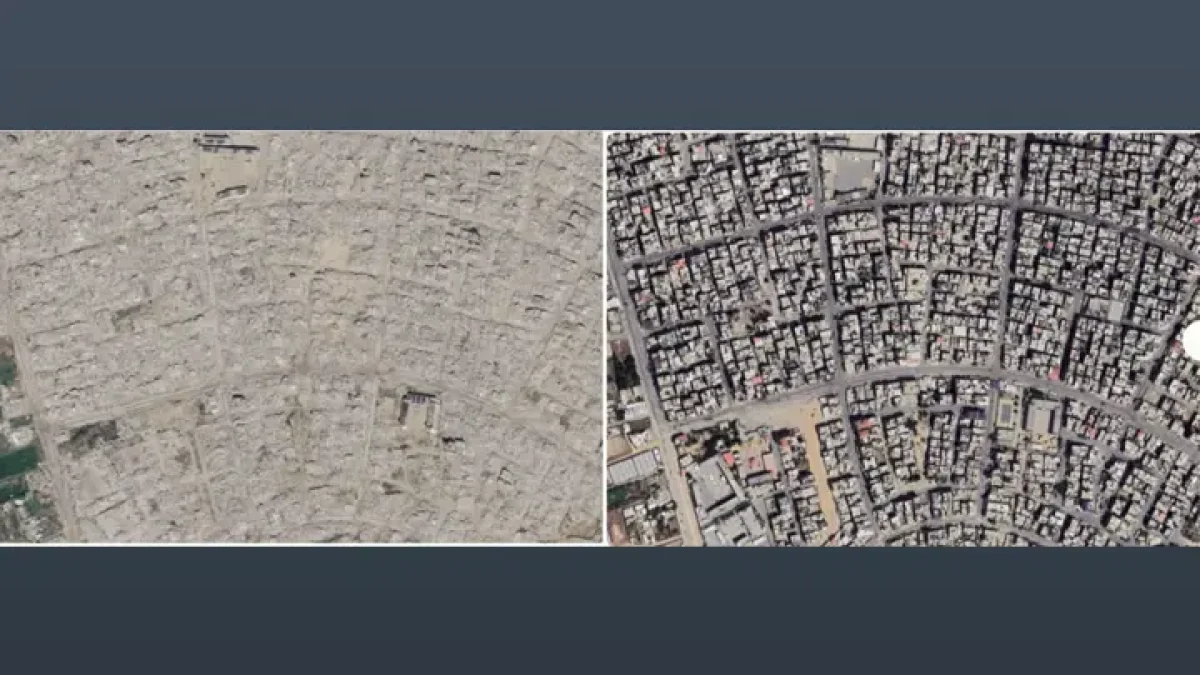
Newly updated satellite images on Google Maps have made clear the scale of destruction caused by Israeli attacks across the besieged Gaza Strip. Nearly three years of Israeli war have turned large parts of the territory into rubble.
The images show residential neighbourhoods razed one after another. In some places only the faint outlines of main roads remain, and the rubble makes it hard to tell one part of Gaza from another.
Much of the land that once held homes, shops and other buildings is now grey rubble. Large stretches of farmland have also been damaged by fire and attacks.
The images also show damage to centuries-old places of worship in Gaza. Some religious buildings have been partly damaged, while others have been completely destroyed.
The new images offer a visible picture of the widespread damage the prolonged war in Gaza has done to infrastructure, residential areas and farmland.
বাংলায় মূল প্রতিবেদন পড়ুন · Read the original Bengali report